


News Headlines

Hazardous Weather Conditions
Current conditions at
Ithaca Tompkins International Airport (KITH)
Lat: 42.49°NLon: 76.46°WElev: 1099ft.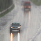
Light Rain
71°F
22°C
| Humidity | 87% |
| Wind Speed | NW 13 G 22 mph |
| Barometer | 29.96 in (1014.0 mb) |
| Dewpoint | 67°F (19°C) |
| Visibility | 10.00 mi |
| Last update | 30 Jun 5:56 am EDT |
Extended Forecast for
Forest Home NY
Today

High: 82 °F
Chance
T-stormsTonight

Low: 54 °F
Slight Chance
ShowersMonday

High: 72 °F
Decreasing
CloudsMonday Night

Low: 50 °F
Mostly Clear
Tuesday

High: 80 °F
Mostly Sunny
Tuesday Night

Low: 63 °F
Mostly Cloudy
Wednesday
High: 85 °F
Partly Sunny
Wednesday Night

Low: 67 °F
Showers
LikelyIndependence Day
High: 85 °F
Partly Sunny
then Chance
Showers
Detailed Forecast
Today
A chance of showers and thunderstorms, mainly before 3pm, then a slight chance of thunderstorms after 4pm. Mostly sunny, with a high near 82. South wind 6 to 11 mph becoming northwest in the afternoon. Chance of precipitation is 40%. New rainfall amounts of less than a tenth of an inch, except higher amounts possible in thunderstorms.
Tonight
A slight chance of showers before 11pm, then a slight chance of showers after midnight. Increasing clouds, with a low around 54. Northwest wind around 9 mph. Chance of precipitation is 20%.
Monday
Mostly cloudy, then gradually becoming sunny, with a high near 72. North wind around 11 mph.
Monday Night
Mostly clear, with a low around 50. North wind around 5 mph becoming calm in the evening.
Tuesday
Mostly sunny, with a high near 80. Calm wind becoming southeast around 5 mph in the afternoon.
Tuesday Night
Mostly cloudy, with a low around 63.
Wednesday
Partly sunny, with a high near 85.
Wednesday Night
Showers likely and possibly a thunderstorm after 8pm. Mostly cloudy, with a low around 67. Chance of precipitation is 60%.
Independence Day
A chance of showers after 2pm. Partly sunny, with a high near 85. Chance of precipitation is 30%.
Thursday Night
A chance of showers before 8pm. Mostly cloudy, with a low around 65. Chance of precipitation is 30%.
Friday
A chance of showers and thunderstorms. Partly sunny, with a high near 83. Chance of precipitation is 30%.
Friday Night
A chance of showers and thunderstorms. Mostly cloudy, with a low around 67. Chance of precipitation is 30%.
Saturday
A chance of showers. Partly sunny, with a high near 84. Chance of precipitation is 40%.
Additional Forecasts and Information
ABOUT THIS FORECAST
Point Forecast:
Forest Home NY
42.44°N 76.48°W (Elev. 801 ft)
42.44°N 76.48°W (Elev. 801 ft)
2:46 am EDT Jun 30, 2024
6am EDT Jun 30, 2024-6pm EDT Jul 6, 2024
Additional Resources
Radar & Satellite Image


Hourly Weather Forecast


